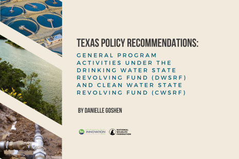
The National Wildlife Federation was recently invited to give testimony to the Texas Legislature on the proposed Texas Coastal Barrier — a sprawling project that includes the so-called ‘Ike Dike’ concrete gate system. Danielle Goshen, policy specialist at the Texas Coast and Water Program of the National Wildlife Federation, spoke to the Texas House of Representatives Natural Resources Committee on Aug 23, 2022.
Goshen noted the many concerns around the project’s increasing costs, decades-long construction timeline, and limited efficacy. She encouraged the state to think beyond the single storm surge project proposed by the Army Corps, and take a more holistic approach to protecting the Texas Coast for our communities, our economy, our way of life, and our rich diversity of fish, wildlife, and coastal resources.
Both a recording of Goshen’s testimony and her full written remarks are included below:
Good morning Chairman King, Vice Chairman Harris, and members of the Committee. My name is Danielle Goshen and I am the Policy Specialist/Counsel for National Wildlife Federation’s Texas Coast and Water Program. I appreciate the opportunity to provide testimony to you all today on the implementation of SB 1160 and ways in which the state can support a coastal barrier system.
The Gulf Coast Protection District was created last year during the 87th Texas Legislature. Composed of five counties, the purpose of the district is to be the local, or non-federal sponsor for the Army Corps’ Coastal Texas Study for the Upper Texas Coast.
According to the latest estimate, the Coastal Texas Study will cost taxpayers $31 billion dollars – a number that continues to rise each time it’s evaluated. As a project seeking federal funds, the GCPD will be tasked with obtaining 35% of the total project cost for the features located in the Upper Texas Coast – estimated at over $26 billion dollars before the most recent cost estimates were provided. David Berry, the Harris County Administrator, said that Harris County alone would likely have to cover $8.3 Billion for the project.
If constructed, this would be the largest Army Corps’ project of its kind. While comparisons are made to gate structures located in the Netherlands and Russia, the size, location, and geography of the Bolivar Roads Gate System, the largest and most complex component of the Army Corps study, are significantly different from the European examples. As opposed to the other examples, the $16 billion Bolivar Roads Gate System would be located at the mouth of a large gulf and would bridge two miles between Bolivar Peninsula and Galveston Island, would have vastly different tie-in structures, and would be located in an active hurricane region.
However, despite over $20 million and six years of study, serious concerns remain about the feasibility of the Army Corps’ plan, its efficacy, and whether Texans can or should have to wait two decades for protection.
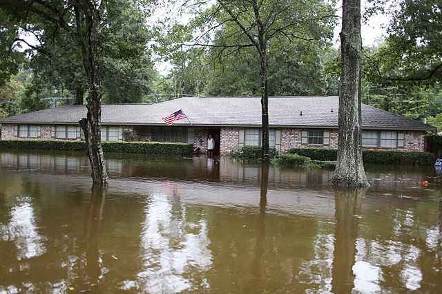
First, despite this astronomical cost, the protection provided by the Army Corps’ plan is narrow and is not a silver bullet for the region. Counter to some incorrect claims from supporters of this project, this $31 billion investment will not protect the Houston area from a Hurricane Harvey like event.1“This project does not reduce regional flooding from high-precipitation storms, like Hurricane Harvey.“ (Feasibility Report, pg. 131).
Instead, the Army Corps specifically limited the project scope to reducing impacts due to storm surge, and does not protect against high winds2“The project will not reduce the damaging effects of hurricane winds.” (Feasibility Report, pg. 131). or rainfall induced flooding 3“It should be noted that Flood Risk Management (FRM), the management of rainfall induced flooding, was omitted from this study as it was determined that adequate authorities and projects/programs already exist to address FRM in the study area, separate from the Coastal Texas Study.” (Feasibility Report, Executive Summary at 3). — which are both commonly associated with storms in the region.
Second, there are valid concerns about the level of protection that the Army Corps’ plan would provide – especially given continued impacts due to climate change. For example, the current plan is designed to protect against the so-called “100-year storm.” However, in determining the return period, the Army Corps used its 2013 Intermediate Sea Level Rise scenario, which matches with NOAA’s 2017 Intermediate-Low scenario. Latest research indicates that the Intermediate to Intermediate-High scenarios are more probable, and are therefore recommended by NOAA to be used for planning. Failing to use recommended climate projections can result in a higher return period than what is being planned for and will reduce the benefit-cost ratio used to determine whether the project should be pursued.
Third, we still do not have sufficient understanding of project impacts on the local environment. A main reason for this is that the first Draft Feasibility Report, released in 2018, received numerous critical reviews during the Independent External Peer Review process. Under this review, the draft plan was likened to “only rise to a reconnaissance level investigation” rather than a Feasibility Study. After this analysis, the U.S. Army Corps switched procedures to undergo a tiered NEPA review. This change delayed the completion of the Environmental Impact Statements, which play an integral role in federal projects, as they ensure that significant environmental impacts and reasonable alternatives are fully considered in connection with the project prior to decision making. Delaying the completion of the EISs means that the Army Corps has selected their preferred alternative and is seeking construction authorization and federal funding for these measures, before fully understanding environmental impacts from the project.
To date, in fact, none of the measures for the Upper Texas Coast have completed their NEPA assessments.4Features of the Recommended Plan requiring Tier Two NEPA assessments include: 1. Bolivar Roads Gate System 2. “Bolivar and West Galveston Beach and Dune System 3. Galveston Ring Barrier System 4. Galveston Seawall Improvements 5. Nonstructural Improvements 6. Clear Lake Gate System and Pump Station 7. Dickinson Bay Gate System and Pump Station 8. South Padre Island Beach Nourishment and Sediment Management 9. Restoration Measure B2 (Follets Island Gulf and Beach Dune Restoration) 10.Restoration Measure W3 (Port Mansfield Channel, Island Rookery, and Hydrologic Restoration). Each feature will require further design details to characterize potential impacts and minimize/avoid these impacts to a degree that satisfies the various resource agencies.” (Feasibility Report, pg. 142). Therefore, even when the Coastal Texas Study is approved for construction under this year’s Water Resources Development Act, or WRDA, years of study will still need to be completed to understand project impacts before the project measures in the Upper Texas Coast are actionable. Major questions that linger regarding project impacts, include:
How will the Coastal Texas Study avoid inducing flooding not only in the Channelview neighborhood on Galveston Island, which is left out of the ring barrier system, but also up and down the coast, including at San Luis Pass, which is just outside of the project footprint?
How will the Bolivar Roads Gate System impact adult fish and shellfish and how will this impact local economies along our coast?5“Potential long-term direct impacts to fish and shellfish with larval and juvenile life stages that depend largely on passive transport could result from the cumulative impacts of theCoastal Barrier. These impacts would include losses resulting from 1) reduced numbers entering the bay proportional to the reduced volume flowing into the bay, 2) loss of individuals trapped in eddies that could form on the backside of the gate structures; 3)increased exposure to predation while migrating across the open bay to the marshes due to reduced velocities and increased transport times; and 4) reduced area of accessible marsh caused by reduced tidal amplitude. Many of these species are important forage species for other species of fish, birds, and dolphins. These other species could experience indirect impacts resulting from reduced access to forage. It is difficult to predict what those impacts could be because few gate structures have been constructed in the world and no studies have been conducted on the ecological impacts these gate structures could cause. Therefore, the exact long-term impacts to the Galveston Bay complex are uncertain and additional studies would be required to best predict the impacts the structure may cause.” (Pg. 4-83 EIS).
During storm scenarios, how will the geomorphology, salinity, and hydrologic regimes of San Luis Pass and West Bay be altered, and what will effects be during gate malfunctioning?
How will the Galveston Bay Ring System handle rainfall when the pump systems are only designed to handle a 25-year rainfall event?6“While the pumps are initially designed to handle 25-year rainfall with surge tail water boundary conditions of 1% AEP (detailed in Section 2.7.4 in Appendix D, the Engineering Appendix), the compound interaction of rainfall and surge has not been fully explored in this phase of the study.” (Feasibility Report, pg. 110).
Because of these concerns and numerous others, it is so important that the GCPD has public engagement at the top of mind. When the GCPD initially convened it did not seem like public engagement or education was a top priority – providing only in-person meetings for the five-county district. Our organization and others repeatedly asked for a virtual option and for better notice of meetings, and it wasn’t until the media told this story that the GCPD took action.
Recently, however, the GCPD has made strides in making its meetings more accessible to the public. While the district continues to see issues with its Hybrid virtual/in-person meetings, we are hopeful that these issues will be resolved shortly, and hope to see more participation from the general public, and not just industry consultants and other interested parties, due to this. Additionally, the GCPD has reached out to numerous non-profit entities in order to engage with stakeholders. We are encouraged by these improvements and hope to continue to see the District improve public engagement.
The reason that the GCPD’s outreach efforts are so important is because, as the entity tasked with raising the 35% local cost share, likely from taxpayers in the five-county area, it is essential that the GCPD informs those residents and potential voters of the best available information about the project so that they can have a clear understanding about its impacts and the protection that the coastal barrier will and won’t provide. Additional ways the GCPD can help improve public participation and increase public education in its meetings include:
- Consistently post meeting recordings on their website or youtube channel in an easy to find location;
- Provide opportunities for virtual public comments during monthly public meetings;
- Provide translation services, when requested; and
- Hold Q&A sessions tailored to each county in the District in order to help inform the public about what protection the Coastal Texas Study would provide.
In terms of the coastal barrier system, National Wildlife Federation feels strongly that the Army Corps’ project is not the silver bullet that it has been made out to be. It is a project aimed at mitigating storm surge, and storm surge only. Until adequate Environmental Impact Statements are completed and provide sufficient evidence that project benefits will outweigh its costs – both economic and ecological, we feel that the state should focus on more tailored solutions using a combination of green and gray approaches, as well as non-structural solutions. These approaches can provide a more holistic and resilient approach to mitigation by protecting communities faster, cheaper, and could even provide multiple benefits to the region. First, multiple nonstructural solutions could play a major role in protecting communities in the Upper Texas Coast. While the Army Corps’ plan includes some non-structural components, they are not a main feature – likely due to narrowing project objectives to storm surge reduction. Investing heavily in elevating homes, floodproofing, and hardening structures can protect homes not only from coastal storm surge, but also from wind and rain. According to FEMA, coastal building codes that require these specifications helped residents on Bolivar Peninsula during Hurricane Ike whose homes were built to code – stating that “building elevation may have been the most important safety factor.”7FEMA, Building Codes Helped Bolivar Peninsula, (last update: February 11, 2021), available at: https://www.fema.gov/case-study/building-codes-helped-bolivar-peninsula. Giving Counties in Texas the authority to adopt enforceable building codes is essential to protecting our communities. Other important features identified by FEMA include setting structures back from the coast, fortifying structures with sturdy materials, and equipping homes with a storm-resistant roof.
It is also worth noting that the Army Corps Feasibility report estimated that the overall cost of managed retreat – or “managed realignment” – a coastal management strategy that allows the shoreline to move inland, instead of attempting to hold the line with structural engineering – for all structures that would be impacted by the 100-year storm under current conditions would be over $30 billion. Not such a far-fetched concept considering the similar price tag for the current proposal.8Feasibility Report, pg. 35
Second, since the Army Corps’ plan is being marketed as a way to protect national security due to the location of the Nation’s largest petrochemical complex located along the Houston Ship Channel, we need to focus on identifying industrial facilities that pose a significant risk to communities, enforce existing facility standards, and and require additional protection, where necessary.
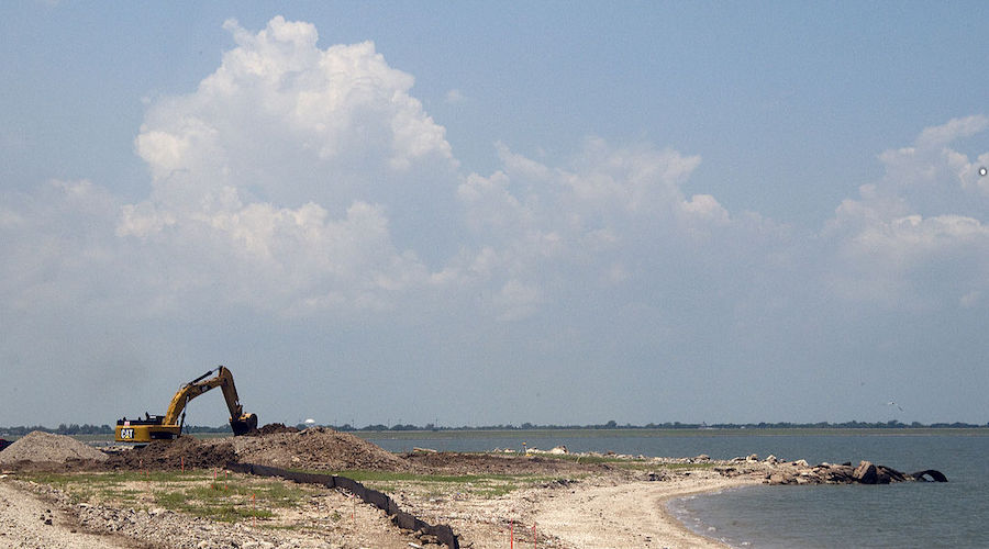
Lastly, we need to properly consider the protective value of nature – and invest in resilient natural and nature-based solutions. These solutions include construction of living shorelines, dune and wetland restoration, and the preservation and rehabilitation of oyster reefs. Natural and nature-based features can often be used in conjunction with levees and other structural investments in order to both increase the efficacy and lifespan of costly projects.
This holistic approach can provide communities with significant protection on a much shorter timeline than the Army Corps proposed project – while also reducing environmental impacts and residual risks such as induced flooding. We therefore encourage the state to think beyond this single storm surge project proposed by the Army Corps, and take a more holistic approach to protecting the Texas Coast for our communities, our economy, our way of life, and our rich diversity of fish, wildlife, and coastal resources.
Thank you for the opportunity to provide this testimony and I’m glad to answer any questions you may have.